|
|
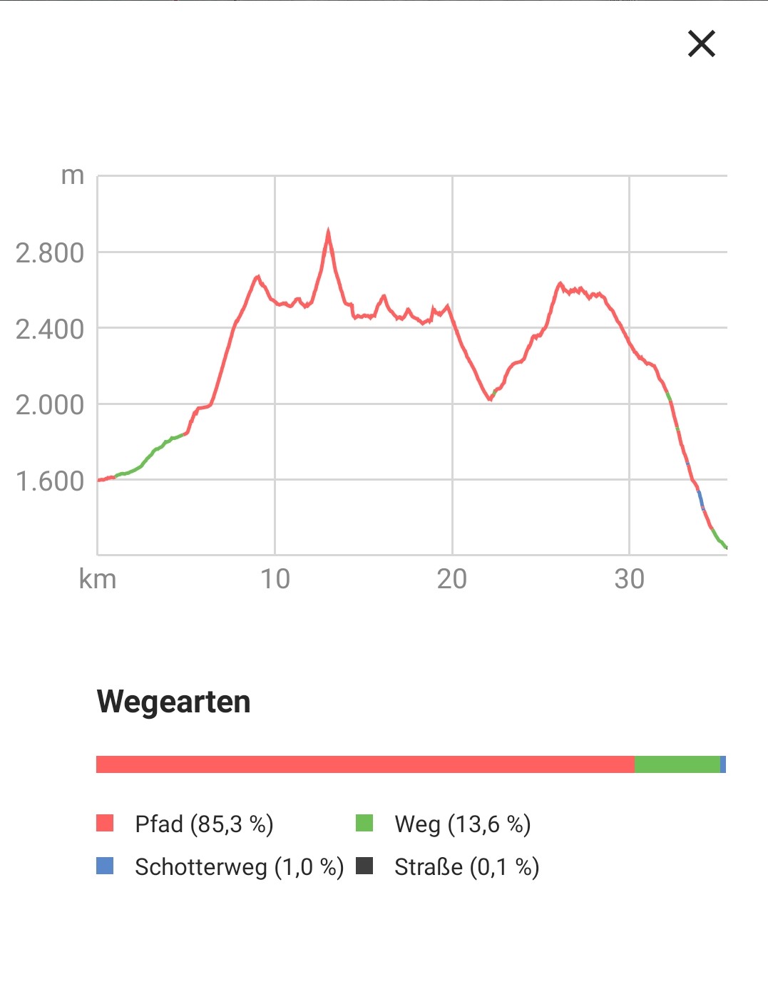
3 countries trail
This great trail round with its diverse landscapes inspires
again and again: Start in Kasern in South Tyrol it is fairly
flat to the Kehrer Alm, easy ascent to the Laner Alm and over
the ground it goes over serpentines to the Birnlücken Hut, and
on to the Birnlücke 2665 m from there it goes straight downhill
again and we are in the Salzburger Land up to the Inner Kassalm
it then goes flat again until shortly before the Krimmler
Tauernhaus Land Tirol takes the 3 country path past the
Windbachalm up to the Tauernpass you take the Schüttalkopf with
you 2773 m with goes down again to the Lausitzer Weg to the
Fuchsalm and back to the starting point in Kasern. |
|
|
| |
 |
|
| |
 |
|
| |
 |
|
| |
|
|
| |
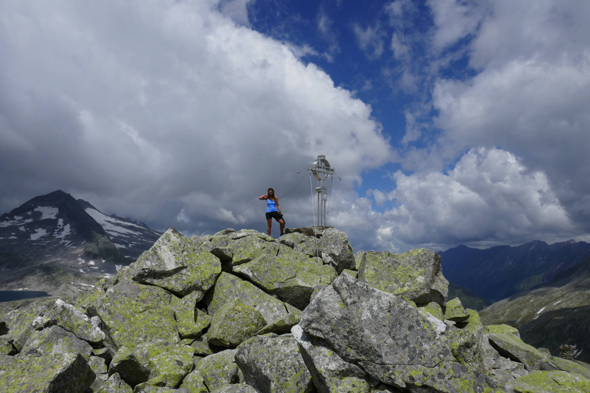
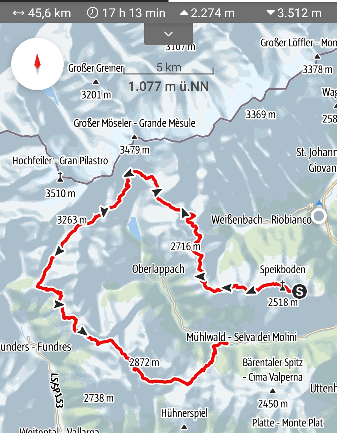
4 hut trail
The 4 Hüttentrail in Ahrntal is a long-distance hiking trail that offers
a dreamlike landscape of glaciers, lakes, grass-covered mountains that
are often like islands in the middle of the high mountains.Start:
Sonnklar Hütte at Speikboden 2430 m takes the Kellerbauerweg to the
Chemnitzer Hütte Neveser Höhenweg to the Edelrauthütte, past the
Eisbruggsee to the Tiefrastenhütte and on over the large Törl 2355 m
descent into the Mühlwalder valley. |
|
|
| |
 |
|
| |
 |
|
| |
 |
|
| |
. |
|
| |
Alm
Trail Prettau-Luttach
Ascent via Prettau through wonderful alpine meadows to the
Alprecht Alm, it continues flat to the White Wall, slight ascent,
Bretterscharte then down to the Durra Alm and on to the Loibiser
Schupfen, immediately afterwards you take the vegetation path to
the Mayerhofer Alm to the sleeping house from there take the
path to the Ahornacher Jochl, to the Pojer Almen to the Steiner
Holm, descent to the Gruber Alm and the last descent to Luttach |
|
|
| |
 |
|
| |
 |
|
| |
 |
|
| |
|
|
| |
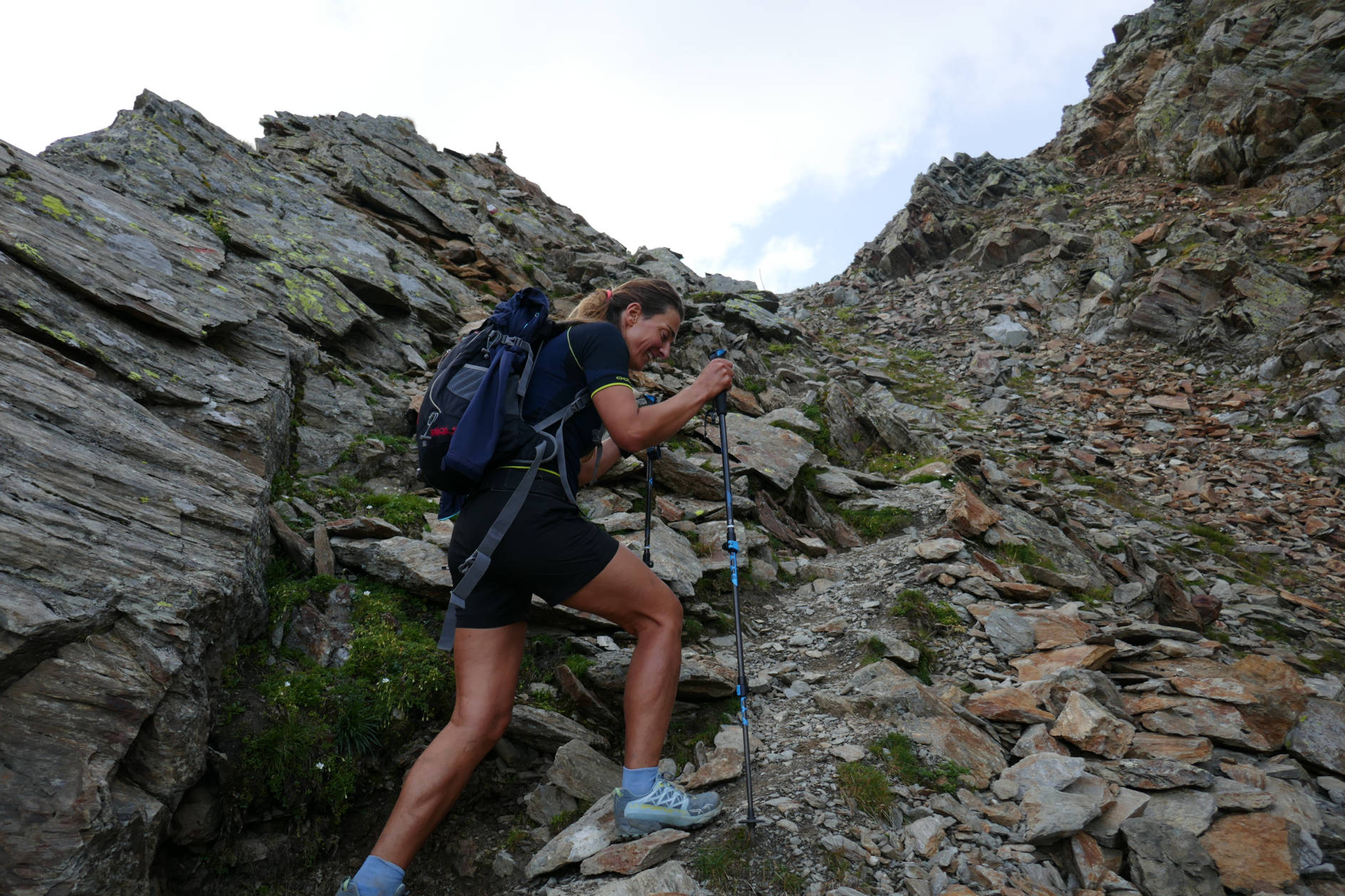
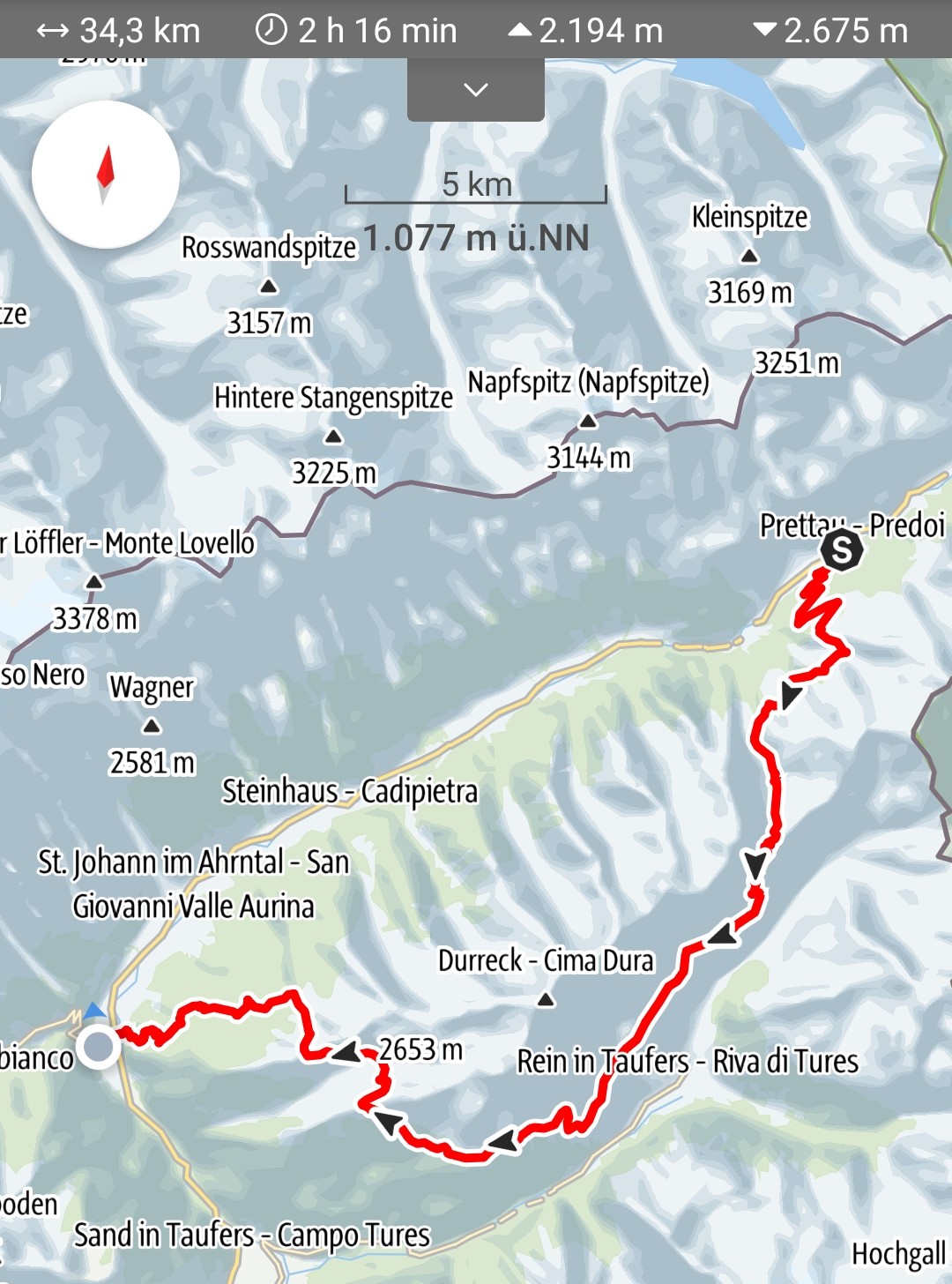
Ahrntal
Trail St.Peter -Luttach
Demanding trail: Start in the village of St. Peter in the
Ahrntal Valley through rustic mountain forests, you get to the
Poinland Valley, over the yoke to the Bürsttal Alm, followed by
the second ascent to 2,492 m and back down to the Bärental Alm
and on to the Hochfeld at 2,296 m, down to the Grubenalm and
then again the ascent to the Breiten Rast on 2098 and on to the
Klaussee and then to the highest point the Rauchkofl 2653 m on
to the Pojenspitz and the Gruberalm and the descent to Luttach.
|
|
|
| |
 |
|
| |
 |
|
| |
 |
|
| |
|
|
| |
Trail
Schwarzenstein StabelerWeg
Start: St. Johann Rotbachalm you walk across fields and meadows
via the Daimerhütte to the Schwarzenstein Hütte 3000 m and up to
the summit 3340 m you go back down the same path to Sandreine,
follow the Stabelerweg towards Chemnitzer Hütte, a slight ascent
to the Zwilchler Törl 2846 m easy descent over the
Schwarzbachtal up to the Schwarzbachtörl 2544 m it then goes
slightly downhill again through the Mitterbachtal and again
uphill to the joint gap 2724 m then it goes downhill again to
the Moosboden and another easy ascent to the Chemnitzer hut
follows the Kellerbauerweg to the Tristensee and after the lake
the descent to Weißenbach to the destination follows
|
|
|
| |
 |
|
| |
 |
|
| |
 |
|
| |
|
|
| |
Trail
Vetta d´Italia
Route: From Kasern along the Ahr on path no.13 into the valley
to the Kehrer Alm (1842 m). Change over the Ahr and over a steep
step through the narrowing valley up to the wide valley floor
with the Lahneralm (1979 m). After the alpine building over the
bridge and through the Lahner Moos to the head of the valley.
From here in numerous serpentines on the beautifully laid out
hut access path up to the Birnlücken hut (2441 m; 3 hours from
Kasern).
Shortly before the hut, path no.13A branches off to the left in
a northerly direction, from which we follow. Starting out two
trenches, then ascending diagonally westwards up to the crossing
Lausitzer Weg. On path no.13, partly slightly uphill and partly
flat in a westerly direction out of the valley, to the junction
to Vetta d´Italia Klockerkarkopf 2912 m. Again down the same
path down the wooden steps of the Teufelsstiege (holding rope)
down into the Kerrachkar. After the cirque, briefly ascending to
the Neugesdorfer Hütte, continue along the Lausitzer Weg past
the picturesque Waldnersee to the Hundskehle to the Samhütten
and the descent to St. Peter.
|
|
|
| |
 |
|
| |
 |
|
| |
 |
|
| |
|
|